
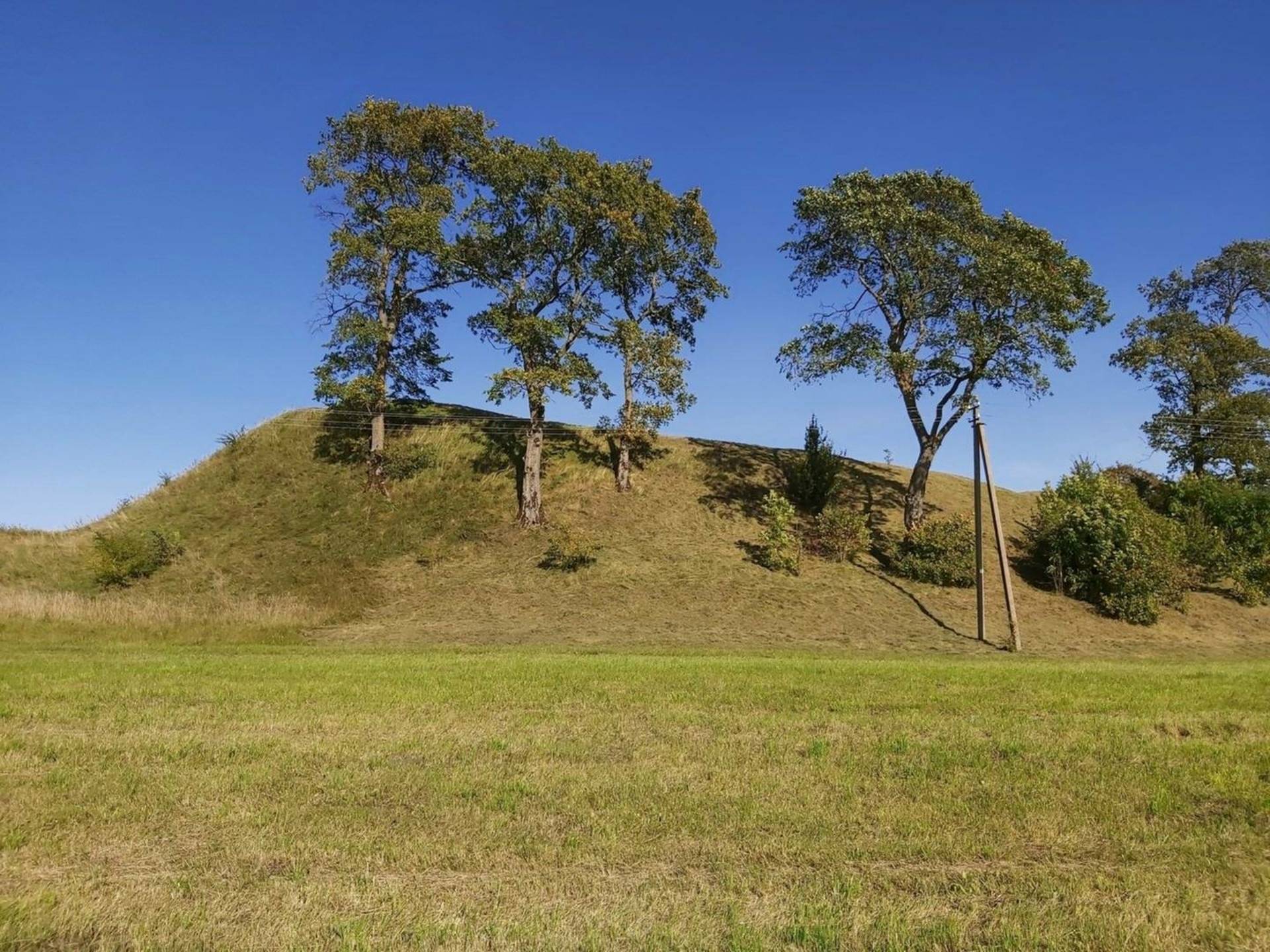
The hillfort was established on an isolated hill. Its northeastern, southeastern, and southwestern slopes are steep, rising to a height of 8–9 m. The northwestern slope is somewhat lower and adjoins a terrace measuring 30 × 35 m and approximately 4 m in height.
The hillfort plateau is oval in shape, oriented along a southeast–northwest axis, measuring 45 m in length and 33 m in width. It was formerly cultivated.
Along the northwestern edge of the plateau stands a heavily disturbed rampart, 22 m long and 3 m high. To the southeast of the hillfort, beyond the village street and on the remaining part of the hill, a burial ground and the village cemetery have been preserved. A short distance to the southwest of the hillfort flows the Luponė Stream, which has been channelized through land reclamation works.
A bailey (outer ward) is located on the northwestern slope, 4 m below the main plateau. Its triangular platform, oriented along a southeast–northwest axis, measures 30 × 35 m. On the southwestern slope, 2 m below the plateau, there is a 5 m wide terrace with an outer scarp 2 m high. The slopes are of moderate steepness and rise to heights of 4–5 m.
The hillfort ramparts have been damaged by military trenches. A survey benchmark has been installed within the northwestern rampart, and at its base, on the plateau side, a rectangular area has been levelled for public gatherings and festivities. The bailey was partially damaged during road construction, and its western corner was cut away during the construction of a homestead.
The hillfort and bailey are currently covered with grassland and fallow vegetation. Several maple trees grow on the slopes of the hillfort, while shrubs cover the slopes of the bailey. Two homesteads stand on the northern side of the hillfort, and another is located on the southwestern side, adjacent to the burial ground and near a local access road.
+1


Reviews